scrying log for gijon
Table of Contents
28/10/08
Added dacwrite function (for the MAX548 DAC) to Scheme interpreter and hardware library:
(dacwrite 128)
[library code for the AVR Atmega128 written in C]:
http://scrying.svn.sourceforge.net/viewvc/scrying/
For prototype LRA [Local Resonance Amplifier] board:
25/09/08
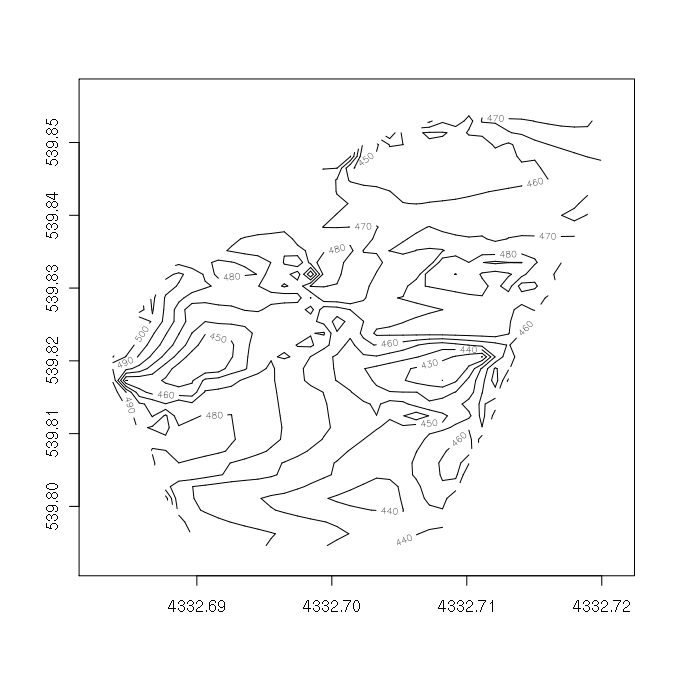
Using the R language to plot/map data sets from the 24th:
apt-get install r-base-dev r-recommended

To install needed packages download neededpackage.tar.gz:

R CMD INSTALL /path/to/package.tar.gz

start up R:

> require(akima)

[for interp]

> mtab<-read.table("24rssifish.log")

[to read into mtab our three space-separated columns]

> contour(interp(mtab[,1],mtab[,2],mtab[,3],duplicate="strip"))

[for image below]

alternatives to contour:

filled.contour

image [like heat map]

persp [3d terrain]

[see also > help(contour) for plenty of options]
24/09/08
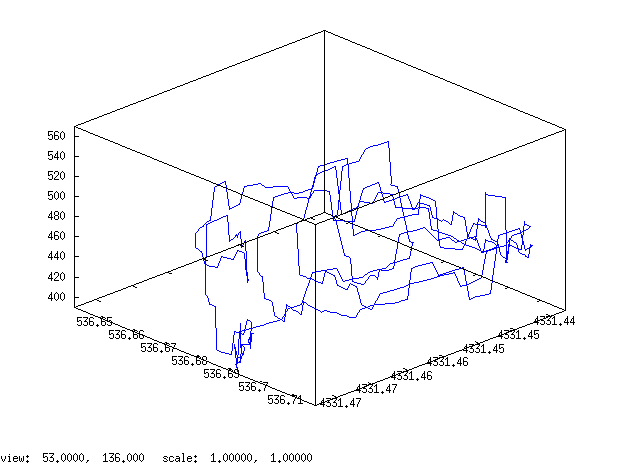
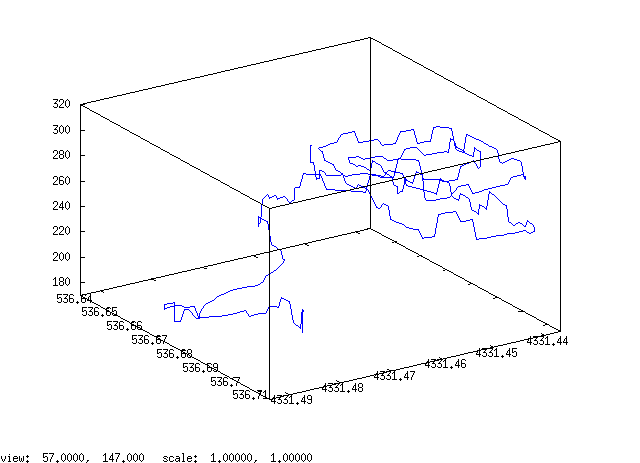
Scrying in centre of Gijon for underground fish farms [see below]:
With bare/small antenna and RSSI with 900-3000 MHz log periodic:

Composite [with code below]:

Higher resolution [ set dgrid3d 300,300,30 ]

set parametric

unset key

set style data line

set surface

set contour both

set cntrparam bspline

set dgrid3d 30,30,10

splot "/root/24antennafish.log" , "/root/24rssifish.log"
// with thanks to Alejo Duque
23/09/08
Hardware integration under the following commands:
[gpsread] [returns parsed lat/long - should be recoded to return a list which we can pull apart!]
[adcread channel number]
[memwrite bank (1 of 8) address value] [returns T]
[memread bank address] [returns value]
TODO: extend Scheme (in Scheme), GPS list, string-to-list in Scheme, logging app in Scheme or close to it, loading of files to serial (or using Emacs).
21/09/08
Scheme is now running on the scrying platform. [Based now on Atsushi Moriwaki's Mini-Scheme interpreter]:

[avr/atmega128/Scheme]
20/09/08
Next generation hardware:
- 2x LED on baseboard for signalling (eg. to signal reception or that GPS is locked on)
- when battery is low we need to switch off power to all peripherals to enable charging
- shape and design of board
19/09/08
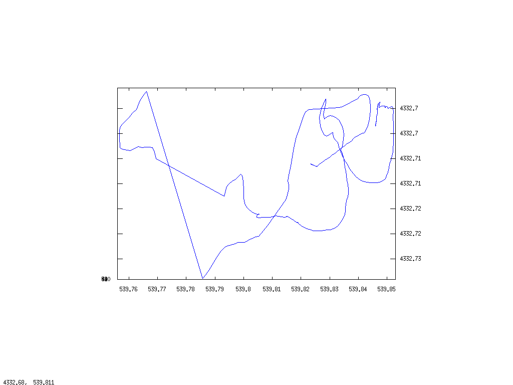
Scrying outside LABoral using spiral scheme to map the territory. Also to test response of different antennas and open antenna/RSSI:
1] RSSI + GHz small whip antenna:


2] RSSI + log periodic antenna [900-3000 MHz]:

3] Bare antenna with small whip:

4] RSSI _ log periodic antenna [400-1000 MHz]:


And combined:

using simple comma separation of tracks in Octave.
TODO: decent transparent overlays in gnuplot.
18/09/08
First scrying excursion in Gijon centre conducted around harbour and Plaza del Marques [site in Roman times of fish salting and farming]
[ref: Rosello, E., and J.M. Canas. 1994. “Analisis de la ictiofauna de la plaza del marques (Gijon).” In Una industria de salazones de epoca romana en la plaza del Marques, edited by C. Fernandez-Ochoa, 189–97. Gijon: Ayuntamiento de Gijon.]
From above:
and:
From Octave we can plot ot a PS file with:
:print("test.ps","-dpsc")
as soon as we have made our plot
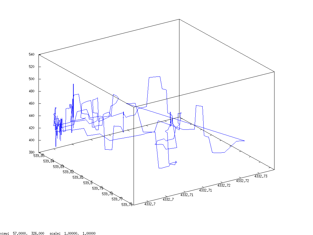
Now using gnuplot to plot intensities as follows:
[first make sure that log file is changed from comma separated values
to tabbed]

gnuplot> unset surface
gnuplot> set view map
gnuplot> set pm3d at b
gnuplot> set dgrid 300,300,3
gnuplot> splot "1809scry.log" using 1:2:3

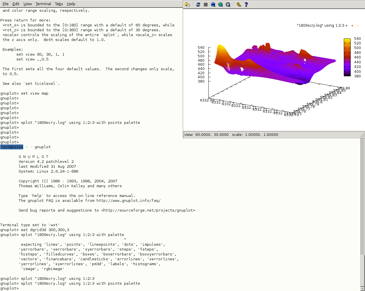
TODO: Massage GPS co-ordinates
notes on further artistic uses of scrying platform:
1] code broadcast stations:
Code is modulated and broadcast by AM or FM transmitters from covert, city-wide, solar-powered scrying stations. scryers move through the city [with devices] - code runs and is modified by architectural and urban EM environmental issues.
2] LRA: Local Resonance Amplifier:
Local Resonance Amplifiers (LRA) are parasitic city devices (PCD) which amplify and dislocate wide band electromagnetic (EM) emissions or signals. Mushroomed LRA devices serve as mute witness, creating significant physical and symbolic imbalances within complex city-wide spectral ecologies: subtle interactions between physical constructions, communication technologies (wireless networks, mobile phone networks, RFID, television, radio, radar), power lines and lines of transmission, biological phenomena, and geologic properties.
3] geologic/archeologic mapping:
Re-mapping techniques/methods from the discipline of archaeological geophysics to use present EM emissions to divine the (hidden) past of an urban location.
http://en.wikipedia.org/wiki/Archaeological_geophysics
For example:
- Electromagnetic methods: EM conductivity
Electromagnetic methods measure the response of the ground due to the propagation of an electromagnetic wave. A transmitter coil is used to generate an electromagnetic field which propagates into the subsurface. As the EM wave travels through the ground, eddy currents are induced in conductors in the subsurface. These eddy currents then generate a secondary magnetic field which is detected by a receiver. Usually, both the primary and secondary fields are detected by the receiver.
[from: http://www.ees.nmt.edu/Geop/Classes/Geop446/Docs/lab5.pdf ]
- Magnetometers
With different materials causing local disturbances within the Earth's magnetic field.
- Ground-penetrating radar (GPR)
Signal strength and timing of a reflected signal.
- bibliography
http://www.cast.uark.edu/nadag/Bibliography/Electromagnetic.htm
http://www.cast.uark.edu/nadag/Bibliography/books.htm
4] reflection of white noise signal for architectural EIP
17/09/08
Started working on scrying library which will wrap up access to serial ports 1 and 2 of the ATmega128, digital pins, ADC, GPS parsing routines, SPI, SRAM memory access, and CYWM commands. The library can thus be used for the projected Scheme interpeter, or for coding standalone applications for scrying in C (using the included Makefile). Code is online, under Subversion version control at:
13/09/08
GPS (Trimble Lassen SQ) locks in around 6 minutes outside with good visibility of sky/horizon. Plot of bare/open antenna stroll around LABoral (very short).
plot3(track(:,1),track(:,2),track(:,3))

TODO: library routines, step down solar supply (is maybe over 6v in bright sunshine), adjust GPS co-ordinates, lock-on LED signal for new GPS board, improved and collected documentation
12/09/08
Small scrying expedition in local LABoral environment (main module + RSSI: see: http://scrying.org/doku.php?id=scrying:module_rssi ). GPS to be fixed (possibly loose antenna connection - perhaps insert some GPS debug commands into logging app.).
Graphing/visualisation using Octave: http://www.gnu.org/software/octave/
M-x octave-mode
track = load 'gijon1209.log'
plot(track(:,3))
C-c TAB C-r to send region to octave (and starting octave this way)

what is RSSI?
Received Strength Signal Indicator see wikipedia: http://en.wikipedia.org/wiki/RSSI
See also details for the AD8313 chip used on the RSSI board: http://www.analog.com/library/analogDialogue/archives/33-03/ask28/
TODO: fix GPS (lock time?), calibrate scrying logging in seconds, log current
Date: 2009-12-31 15:40:54 GMT
HTML generated by org-mode 6.31trans in emacs 23